Increasing Public Safety in the Age of Bike and Scooter Sharing: How AI and Analytics Can Help
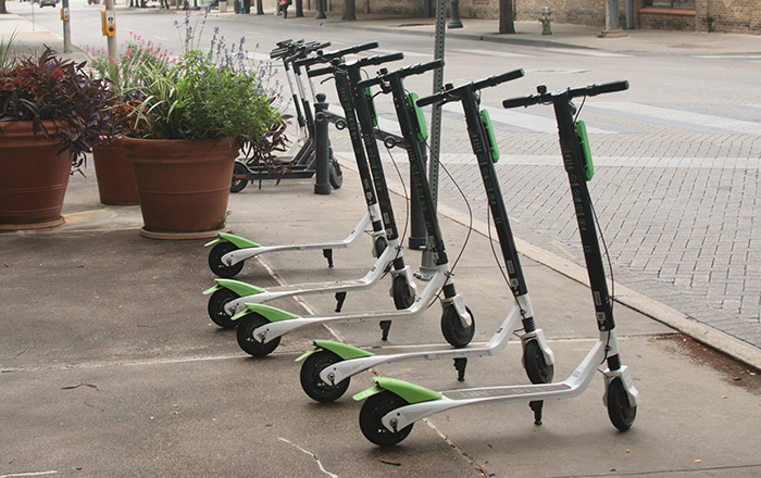
Cities are always looking for ways to make navigating more comfortable for residents and visitors. Trending in many cities today, app-connected bike and electric scooter sharing programs are popping up worldwide, offering a new way to get around when driving or taking public transportation is a less desirable option. In the United States alone, tens of thousands of dockless scooters have been made available on the streets of cities large and small.
While increasing mobility and offering cost-effective, environmentally friendly and fun alternatives to taking public transportation or personal cars, these unregulated vehicles create new public safety challenges to their operators and other pedestrians and drivers. Law enforcement is contending with accidents and property damages caused by these vehicles – learning how to combat abuse and prevent riding under the influence, among other dangers. Local hospitals are facing increases in demands for emergency care, caused by collisions and riding without a helmet. Municipal governments – who often haven’t been forewarned about planned scooter installations – must determine how to balance the benefits of this comfortable mode of urban transit, while ensuring that these ride sharing options are being used safely and responsibly.
Access to comprehensive data intelligence is critical for cities to overcome the challenges born of the scooter and bike sharing revolution. This post will delve into the reasons why actionable insight will be the driver of better city planning and operations around current and future evolutions in transit.
Urban Planning, Public Safety and Law Enforcement
Traffic optimization is a major focus of city governments and law enforcement. In the past, this endeavor often revolved around speculation and expert consulting, because cities didn’t have full insight into traffic activity and patterns. Technological innovation is empowering cities to leverage data intelligence to optimize pedestrian and vehicular traffic flows. Utilizing existing infrastructure, cities can extract data to inform planning and decision making. For instance, cities with smart video surveillance installations, can integrate video content analytics (VCA) to make video searchable, quantifiable and actionable.
Driven by artificial intelligence and based on extracted metadata, VCA solutions enable cities to quantify and classify vehicles and pedestrians, discover their movement patterns and identify traffic hotspots. As such, these systems can be used to track vehicles, such as rental bikes, to inform urban planning efforts and accommodate new city transit trends. They can also be used by law enforcement to identify traffic violations, such as riding without a helmet or in areas not intended for bike or scooter traffic. Video data can be correlated with data from other sources as well – even the scooter and bike rental apps, which track activity using GPS, to provide comprehensive insight into movement and navigation patterns to support traffic optimization, enforcement and safety.
Healthcare and Emergency Response
In the aftermath of an accident or collision, video analytics insights can also help law enforcement understand what occurred, enabling them to filter out irrelevant details from the video review and quickly pinpoint objects of interest. This data enables police to share information and pertinent details with emergency responders and medical personnel, supporting their efforts to treat injuries.
Fully appreciating the importance of data-driven planning, the Zuckerberg San Francisco General Hospital led a charge to implement data collection strategies ahead of reintroducing dockless scooters to the streets of San Francisco. When ride-sharing scooters appeared unannounced in San Francisco in 2018, they were quickly removed by the city due to public safety concerns. According to the hospital’s chief of emergency medicine, Dr. Chris Colwell, “We were seeing five to 10 injuries from this a week, and I’m probably underestimating that. We saw one or zero a month before the increase in electric scooters.”
Realizing the technology’s benefits, the city wanted to responsibly reintegrate the scooter ride-sharing options, and the medical center insisted that the ability to collect and analyze data was integral to this plan and to ensure effective response in case of emergencies. “When technology enters transportation… it also becomes public health,” explains Dr. Catherine Juillard, a trauma surgeon at Zuckerberg San Francisco General Hospital. With access to actionable data, public health and safety can be prioritized and comprehensively addressed.
Data-Driven Digital Transformation
Cities embracing digital transformation, from increased connectivity to intelligent video surveillance and alternative urban transit, can be driven by the data generated from their infrastructure, including new scooter and bike rental apps. The data about traffic trends, common injuries and damages and more can empower cities to develop relevant regulation surrounding the use of shared vehicles. It also can help cities expose “transit deserts,” or areas without proper public transportation coverage or for which current transit options are unaffordable.
Providing data to support urban planning, scooter and bike sharing app data is key for driving traffic optimization in cities. Demonstrative of key smart city fixtures – including increased connectivity, mobility, sustainability and innovation – ride-sharing apps provide alternatives for reducing car traffic and congestion and parking challenges. Cities are thereby able to reduce environmental, road maintenance and public transit operational costs, as a result.
While not without its challenges, ride-sharing apps and the associated scooters and bikes are drivers and beneficiaries of the AI and analytics-driven city: They enable urban institutions to visualize and understand traffic patterns and trends, identify problem hotspots and causes of accidents, and inform planning to optimize infrastructure and traffic flows for visitors and residents – whether they choose to mobilize on foot, by car or on a rental bike or scooter.
To see a live demo at our upcoming trade show, click the image below to book your demo. Slots are filling quickly!